INTRODUCTION
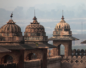
Krishnapura chhatris are located at Indore city of Madhya Pradesh in Central India. They are associated with Holkar rulers who ruled over this Malwa region for long time and did lot of work in this region.
HOW TO REACH
Reaching Indore by Air :-
Indore city in Madhya Pradesh have its own developed airport connected with major cities of India.
DISTANCE CHART
|
LOCATION MAP
|
From
|
Distance
(in Kms)
|
Map Data
Map data ©2019 Google

Map DataMap data ©2019 Google
 
This page can't load Google Maps correctly.
|
|
|
|
|
|
|
|
|
|
|
|
|
Reaching Amarkantak by Train/ Railways :-
The nearest railhead to Amarkantak is Pendra Road at a distance of 17 km from the heart of the city. Anuppur at distance of 48 km from Amarkantak is also convenient for the tourists. Taxi charges are Rs 300 from Pendra Road and Rs 600 from Anuppur.
Reaching Amarkantka by Bus / Roadways :-
There are state owned transport buses from Pendra Road, Shahdol and Bilaspur. Amarkantak is connected by buses to Jabalpur (245 km), Rewa (261 km) and Shahdol (67 km).
TOURIST ATTRACTIONS
Content coming soon....
CLIMATE & WEATHER
Content coming soon....
BEST TIME TO VISIT
Content coming soon....
ACCOMMODATION
Content coming soon....
NEXT TO
Content coming soon....